

Biodiversity

Background
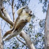
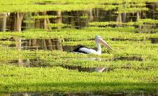
Biodiversity refers to all the different forms of life found in the world. Everything from the plants and animals to the fungi and micro-organisms. It includes the variety of their genetic information, the places they live in (like land, rivers, coasts, and oceans), and how they interact with other living things and their environment.
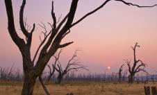
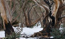
Sadly, Victoria’s biodiversity is in decline. More than half our native vegetation has been cleared since colonisation. And many of our native plant and animal species are at risk from a range of pressures, including climate change.
In 2020 the Department of Land, Water and Planning (DELWP) made a submission to the Victorian Legislative Council Environment and Planning Committee Inquiry into ecosystem decline in Victoria.
In their submission, DELWP reported that
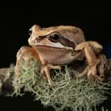
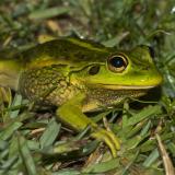
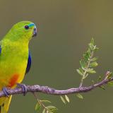
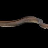
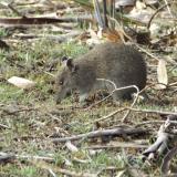
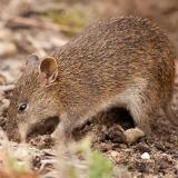
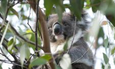
one quarter to one third of “Victoria’s terrestrial plants, birds, reptiles, amphibians and mammals, along with numerous invertebrates and ecological communities, are considered threatened with extinction.”
Since colonisation, the following numbers of species have become extinct:
-
18 mammals
-
2 birds
-
1 snake
-
3 freshwater fish
-
6 invertebrates
-
51 plants.
According to the DELWP submission:
“The longer-term outlook for many threatened species and habitats that rely on Victoria’s approximately 8-million-hectare public land estate for their conservation is poor.”
DELWP added that protecting the state’s biodiversity, habitats and public lands estate will require biodiversity conservation to be given greater consideration in decisions involving public land uses.
The main drivers of biodiversity’s decline have been:
-
urban development
-
mining
-
timber harvesting
-
bushfires
-
river regulation
-
clearing for agriculture
-
climate change.
The result is an increasing threat to Victoria’s biodiversity that includes:
-
highly fragmented native vegetation
-
habitat loss and degradation
-
reduced connectivity
-
loss of ecological processes and functions.
This means that wildlife are less able to move safely through habitat regions. For instance, they are more vulnerable to predators, their food source is more likely to be reduced and their natural rhythms are likely to disrupted by urban environments.
Although the decline of Victoria’s biodiversity continues, there is recognition of the need for, and increasing commitment to, action.
In April 2017 the Victorian Government released ‘Protecting Victoria’s Environment: Biodiversity 2037’ (Biodiversity 2037). It was developed to address the decline in the state’s biodiversity.
Biodiversity 2037 presents a long-term vision for Victoria’s biodiversity supported by 2 goals:
-
Victorians value nature
-
Victoria’s natural environment is healthy.
Biodiversity 2037 sets targets for both goals. Progress is reported annually and is assessed in the ‘Threats and responses’ and ‘Conservation and community engagement’ sections of this chapter.
The Victorian Government’s commitment to the implementation of Biodiversity 2037 includes funding for landscape-scale projects, iconic species projects and grants for community and volunteer action groups. Government agencies, Traditional Owners, Catchment Management Authorities (CMAs), community organisations and landholders are working together across the state to improve the health of Victoria’s environment through projects that include the control of invasive species and the restoration of local areas and broader landscapes.
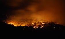
Along with funding limitations, the implementation of Biodiversity 2037 has been impacted by 2 major events since the State of the Environment 2018 Report. The first being the 2019-20 bushfires, followed immediately by the COVID-19 pandemic.
Overview
In April 2017 the Victorian Government released 'Protecting Victoria’s Environment: Biodiversity 2037' (Biodiversity 2037).
In 2020 DELWP made a submission to the Victorian Legislative Council Environment and Planning Committee Inquiry into ecosystem decline in Victoria.
In 2022 the Royal Society of Victoria published 'Towards Conservation & Recovery of Victoria's Biodiversity.'
According to all these reports, as well as others, Victoria's biodiversity is in decline.
Through the assessment of 40 indicators across 4 sub-themes, this key topic considers ‘where' and 'what’ is in decline and reviews data and information provided by the government and community groups in response to the ongoing threats that continue to drive that decline.
The assessments highlight the lack of, or gaps in, biodiversity monitoring, data analysis, interpretation and reporting in the following areas:
-
the condition and diversity of ecosystems and ecological vegetation classes (EVCs)
-
the distribution and abundance of threatened species
-
time series data for the assessment of trends
-
a focus on inputs and outputs rather than analysis and reporting of outcomes in projects for threat management and biodiversity recovery and restoration
-
interpretation of data and its reporting to the public
-
integration and coordination of data gathering by government and community organisations
-
data gathering about biodiversity management activities on private land
-
delays in releasing data.
The status of many indicators remains poor and several deteriorating trends continue. However, confidence in the assessments is generally low due to limitations with the data (e.g. lower quality data and gaps in monitoring).
This is also the case for the new SoE 2023 indicators in the 'Threatened species' sub-theme. Assessment of the indicators in the 'Ecosystem health' sub-theme found mixed results, with status ranging from poor for grasslands, wetlands and rivers, fair for riparian vegetation, mallee and heathlands, and good for alpine ecosystems.
Ecosystem health
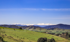
Indicators B:02 to B:11 assess the health of some of Victoria's key ecosystems. In general, Victoria’s ecosystems have been largely stable in recent years. However, the trends in condition of wetlands, grasslands, and potentially alpine and subalpine areas, are in decline. Ecosystems in North-Eastern Victoria and East Gippsland have been severely impacted by the 2019-20 bushfires. The biodiversity effects of the floods in 2022 are yet to be determined.
The assessment of indicator B:01 finds that change in land-cover classes continues in Victoria. Natural areas are being replaced with other uses, such as urban and agricultural areas, in some parts of the state.
The conservation status of many of the EVCs within the assessed ecosystems are either endangered, vulnerable or depleted. Protection levels vary. Most alpine EVC extents are found within protected areas in contrast to the low levels of protection for grasslands. For some vegetation classes, much of their remaining extent is on private land. This means their conservation could depend on landowners establishing permanent protection for them.
Long-term surface water availability across southern Victoria has declined due to drier conditions. Ongoing human population growth and agricultural development, along with reduced river flows due to climate change, will increase pressure on water resources. It will also impact wetlands (B:02), groundwater-dependent ecosystems (B:04), rivers (B:05), riparian vegetation (B:06), floodplain EVCs (B:07) and Ramsar sites (B:03). A lack of data on the condition of, and diversity within, EVCs is an ongoing issue for indicator assessment.
An action statement is an important step in the protection of a threatened species. It sets out what has been done in the past and identifies potential future actions to conserve and manage a species. Few of the individual species in the groups assessed in indicators B:12 to B:23 have action statements to guide their recovery. And those that do exist are often old and have not recently been reviewed. Despite the lack of action statements, projects to support certain threatened species are a key focus for government agencies, CMAs, local communities, Traditional Owners and Aboriginal communities, and research institutions. The immediate government and community biodiversity response and recovery actions following the 2019–20 bushfires were well-resourced, well-coordinated and targeted threatened species.
Assessment of the indicators in this key topic has been hampered by the lack of data on the distribution and abundance of threatened species.
Threats and responses
Indicators B:24 to B:32 assess the threats from invasive species and the management response by government and community. Although invasive plants and animals are the major threat to many threatened species, there remains very limited data on their numbers and abundance.
The full effect of the 2019–20 bushfires on invasive species is yet to be documented. However, concerns that they could exploit the post-fire vulnerability of native species led to a significantly expanded effort to control them. This included aerial and ground shooting operations to cull introduced terrestrial herbivores such as deer, goats, and pigs.
Each year DEECA reports how much progress has been made towards achieving the targets in Biodiversity 2037. This reporting helps inform whether we’re moving towards our vision of healthy Victorian biodiversity that’s valued and actively cared for. The initial 5 years of data since the plan's release in 2017 suggest the annual targets for pest herbivore, pest predator and weed control in priority areas are not being met.
Indicator B:33 assesses the extent and condition of native vegetation. It finds the losses of native vegetation documented in the SoE 2018 Report have continued. Losses are also occurring on public land, although these are counterbalanced by restoration and the control of invasive species.
Habitat can be compromised by invasive species, climate change, fire and other factors and become less suitable for native species (B:34 and B:35). Change in suitable habitat (B:34) estimates the improvement in suitable habitat for individual species in 50 years’ time by comparing implemented actions with a no-action scenario. The assessment, done by DELWP, found that for more than 50% of species there was no improvement or a very small improvement. The Biodiversity 2037 target is for a 100% net positive change (on average) in suitable habitat for threatened species in 50 years.
Conservation and community engagement
Indicators B:36 to B:40 assess conservation and community engagement. Approximately 62% of Victorian land is privately owned. Findings include that only 1% to 2% of private agricultural land is managed for conservation (e.g. native vegetation protection, revegetation and livestock exclusion). Furthermore, almost 90% of the EVCs that are poorly represented in parks and reserves are found on private land.
Biodiversity 2037 estimated there was a gap of over 2 million hectares between the existing protected area network (e.g. National Parks) and what was required for it to become Comprehensive, Adequate and Representative (CAR). The CAR reserve system ensures we protect biodiversity in a way that is:
-
Comprehensive - includes a full range of vegetation communities
-
Adequate - is large enough to maintain species diversity
-
Representative - conserves each vegetation community’s diversity.
In some areas, such as the Victorian Volcanic Plain, Wimmera, Dundas Tablelands and Gippsland Plain, Biodiversity 2037 indicated this would require land purchase or additional formal protection of habitat on private land. However, despite efforts to increase the conservation of native vegetation on private land (B:36) and revegetate both private and public land (B:38), there has been little progress in achieving state wide targets.
Priority 18 of Biodiversity 2037 is to 'Maintain and enhance a world-class system of protected areas.’ However, protection levels for Victoria’s ecosystems have been largely stable since then, with only small additions to the protected areas network (B:37). In response to the Victorian Environmental Assessment Council (VEAC) Central West Investigation recommendations, in 2021 the Victorian Government committed to the creation of 3 new national parks. These were to be complemented with new conservation parks, nature reserves and bushland reserves. These are yet to be legislated and gazetted.
The 2019–20 bushfires and the COVID-19 pandemic restricted the engagement of people in nature-based activities and, accordingly, impacted the achievement of Biodiversity 2037 targets. Despite this, surveys show that the target of more than 5 million Victorians acting for nature has been met. However, there has been a shortfall in meeting the target for all 'Victorians connected to nature' (B:39).
Report card
| Location | |||
|
Statewide |
|||
| Location | STATUS | TREND | CONFIDENCE |
|
Statewide |
|||
| Location | |||
|
Statewide |
|||
| Location | STATUS | TREND | CONFIDENCE |
|
Statewide |
|||
| Location | |||
|
Inland Ramsar sites: Barmah Forest, Edithvale Seaford wetlands Gunbower Forest, Hattah-Kulkyne Lakes, Kerang Wetlands, Lake Albacutya, Western District Lakes |
|||
| Location | STATUS | TREND | CONFIDENCE |
|
Inland Ramsar sites: Barmah Forest, Edithvale Seaford wetlands Gunbower Forest, Hattah-Kulkyne Lakes, Kerang Wetlands, Lake Albacutya, Western District Lakes |
|||
| Location | |||
|
Statewide |
|||
| Location | STATUS | TREND | CONFIDENCE |
|
Statewide |
|||
| Location | |||
|
Statewide |
|||
| Location | STATUS | TREND | CONFIDENCE |
|
Statewide |
|||
| Location | |||
|
Statewide |
|||
| Location | STATUS | TREND | CONFIDENCE |
|
Statewide |
|||
| Location | |||
|
CMA and local reaches level |
|||
| Location | STATUS | TREND | CONFIDENCE |
|
CMA and local reaches level |
|||
| Location | |||
|
Statewide |
|||
| Location | STATUS | TREND | CONFIDENCE |
|
Statewide |
|||
| Location | |||
|
Victorian Volcanic Plain, Wimmera Plain, Gippsland Plain and Warrnambool Plain bioregions |
|||
| Location | STATUS | TREND | CONFIDENCE |
|
Victorian Volcanic Plain, Wimmera Plain, Gippsland Plain and Warrnambool Plain bioregions |
|||
| Location | |||
|
Victorian Alps bioregion |
|||
| Location | STATUS | TREND | CONFIDENCE |
|
Victorian Alps bioregion |
|||
| Location | |||
|
Lowan Mallee and Murray Mallee bioregions |
|||
| Location | STATUS | TREND | CONFIDENCE |
|
Lowan Mallee and Murray Mallee bioregions |
|||
| Location | |||
|
Statewide |
|||
| Location | STATUS | TREND | CONFIDENCE |
|
Statewide |
|||
| Location | |||
|
Statewide |
|||
| Location | STATUS | TREND | CONFIDENCE |
|
Statewide |
|||
| Location | |||
|
Statewide |
|||
| Location | STATUS | TREND | CONFIDENCE |
|
Statewide |
|||
| Location | |||
|
Statewide |
|||
| Location | STATUS | TREND | CONFIDENCE |
|
Statewide |
|||
| Location | |||
|
Statewide |
|||
| Location | STATUS | TREND | CONFIDENCE |
|
Statewide |
|||
| Location | |||
|
Statewide |
|||
| Location | STATUS | TREND | CONFIDENCE |
|
Statewide |
|||
| Location | |||
|
Statewide |
|||
| Location | STATUS | TREND | CONFIDENCE |
|
Statewide |
|||
| Location | |||
|
Statewide |
|||
| Location | STATUS | TREND | CONFIDENCE |
|
Statewide |
|||
| Location | |||
|
Statewide |
|||
| Location | STATUS | TREND | CONFIDENCE |
|
Statewide |
|||
| Location | |||
|
Statewide |
|||
| Location | STATUS | TREND | CONFIDENCE |
|
Statewide |
|||
| Location | |||
|
Statewide |
|||
| Location | STATUS | TREND | CONFIDENCE |
|
Statewide |
|||
| Location | |||
|
Statewide |
|||
| Location | STATUS | TREND | CONFIDENCE |
|
Statewide |
|||
| Location | |||
|
Statewide |
|||
| Location | STATUS | TREND | CONFIDENCE |
|
Statewide |
|||
| Location | |||
|
Statewide |
|||
| Location | STATUS | TREND | CONFIDENCE |
|
Statewide |
|||
| Location | |||
|
Statewide |
|||
| Location | STATUS | TREND | CONFIDENCE |
|
Statewide |
|||
| Location | |||
|
Statewide |
|||
| Location | STATUS | TREND | CONFIDENCE |
|
Statewide |
|||
| Location | |||
|
Statewide |
|||
| Location | STATUS | TREND | CONFIDENCE |
|
Statewide |
|||
| Location | |||
|
Statewide |
|||
| Location | STATUS | TREND | CONFIDENCE |
|
Statewide |
|||
| Location | |||
|
Statewide |
|||
| Location | STATUS | TREND | CONFIDENCE |
|
Statewide |
|||
| Location | |||
|
Statewide |
|||
| Location | STATUS | TREND | CONFIDENCE |
|
Statewide |
|||
| Location | |||
|
Statewide |
|||
| Location | STATUS | TREND | CONFIDENCE |
|
Statewide |
|||
| Location | |||
|
Statewide |
|||
| Location | STATUS | TREND | CONFIDENCE |
|
Statewide |
|||
| Location | |||
|
Statewide |
|||
| Location | STATUS | TREND | CONFIDENCE |
|
Statewide |
|||
| Location | |||
|
Statewide |
|||
| Location | STATUS | TREND | CONFIDENCE |
|
Statewide |
|||
| Location | |||
|
Statewide |
|||
| Location | STATUS | TREND | CONFIDENCE |
|
Statewide |
|||
| Location | |||
|
Statewide |
|||
| Location | STATUS | TREND | CONFIDENCE |
|
Statewide |
|||
| Location | |||
|
Statewide |
|||
| Location | STATUS | TREND | CONFIDENCE |
|
Statewide |
|||
| Location | |||
|
Statewide |
|||
| Location | STATUS | TREND | CONFIDENCE |
|
Statewide |
|||
| Location | |||
|
Statewide |
|||
| Location | STATUS | TREND | CONFIDENCE |
|
Statewide |
|||
* Target 1: All Victorians are connected to nature
| Location | |||
|
Statewide |
|||
| Location | STATUS | TREND | CONFIDENCE |
|
Statewide |
|||
* Target 2: More than 5 million Victorians acting for nature
| Location | |||
|
Statewide |
|||
| Location | STATUS | TREND | CONFIDENCE |
|
Statewide |
|||
Stories

Explore key topics
All topics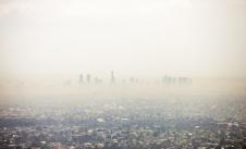

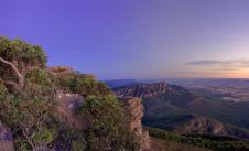
Banner image courtesy of Visit Victoria