Forests

Background
The definition of ‘forest’ used by Australia’s National Forest Inventory, established in 1988, is:
'An area, incorporating all living and non-living components, that is dominated by trees having usually a single stem and a mature or potentially mature stand height exceeding 2 metres and with existing or potential crown cover of overstorey strata about equal to or greater than 20%. This includes Australia’s diverse native forests and plantations, regardless of age. It is also sufficiently broad to encompass areas of trees that are sometimes described as woodlands.'
This definition of forests also includes a minimum area of 0.2 hectares (2000 square metres).
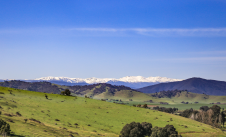
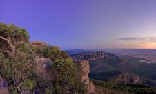
Public land in Victoria covers around 8 million hectares, which is approximately a third of the State. Most of the public land is made up of national parks and other conservation parks managed by Parks Victoria (4 million ha) and state forests managed by DEECA (3.2 million ha).
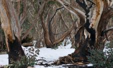
Victorian forests are a mix of:
-
box, ironbark and gun-barked eucalypts in central Victoria
-
medium and tall damp sclerophyll forests across much of Victoria
-
tall wet sclerophyll forests in the east of the state
-
dry sclerophyll forests in the east, central and south-west of the state
-
rainforests
-
mallee forests in north-western Victoria.
Eucalypts dominate Victorian forests and include:
-
red and brown stringybarks
-
narrow-leaved peppermint
-
messmate stringybark
-
mountain ash
-
alpine ash
-
river red gum.
Since colonisation, more than 14 million hectares (60%) of Victorian land has been cleared, mainly for agriculture and settlements. As a result of colonisation, the clearing of land also coincides with the departure from traditional land management by Traditional Owners, including cultural burning. This resulted in significant ecological changes to Victoria's natural environment and increased risks to community.
Victoria’s population growth and subsequent urban expansion will increase the pressure on Victorian forests through elevated water demand from forest catchments and wood products from timber harvesting. The Victorian SoE 2018 Report indicated that there were several major issues for long-term sustainable forest management in Victoria. These were:
-
changing fire regimes
-
deteriorating biodiversity
-
forest fragmentation
-
economy
-
the legal framework.
These issues require constant maintenance to avoid making Victorian forests more vulnerable to achieving sustainable forest management.
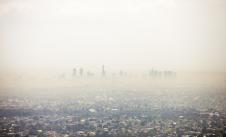
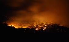
Climate change has been the main driver behind Australia having more frequent and extreme bushfires that could result in having more severe forest destruction.
This is likely to continue with considerable implications for sustainable forest management. As a result of the 2019–20 bushfires, around 10% of vegetation (758,056 ha) was burnt on public land while it was still below minimum Tolerable Fire Interval (TFI). This is by far the greatest extent burnt while the ecosystem was below minimum TFI since 1980. This means that such areas have an increased likelihood of the vegetation undergoing a long-term, and potentially, irreversible change in its composition and structure (e.g. alpine ash forest being replaced by acacia thickets).
In the rapidly changing climate trend, water yield estimation is becoming more difficult. The impacts of high-frequency, high-severity fires on mixed species are currently unknown. This is due to the worsening fire regime potentially causing some species to disappear and be replaced by different species in the same area.
Additional issues identified over the last 5 years include:
Lack of data in biodiversity: Assessment to determine a species' status can vary in accuracy and reliability due to data gaps and limited expert knowledge for some species. This is mainly because agencies focus on arresting the decline of selected species and communities. This leads to reliance on expert knowledge of the species which, at times, does not exist or is not current. In addition, 21 species listed under the Flora and Fauna Guarantee Act 1988 (FFG Act) as critically endangered were identified to have critical knowledge gaps.
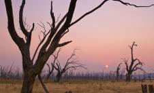
Deteriorating trend in old-growth forest extent: Old growth forests are important in the maintenance of biodiversity and ecological functions, such as water and nutrient cycles. About 60% of modelled extent of old growth forest have been lost, predominantly due to severe bushfires since 2000. The increasing trend in fire intensity and frequency due to climate change means there is a higher chance that the loss of old growth forest modelled extent could be accelerated.
Overview
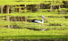
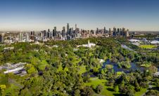
Forests, and the services they provide, are essential for the health and wellbeing of all Victorians. Victorian forests maintain the state’s water quality, purify the air and store carbon. They stabilise and nourish soil, assist agriculture, and support economies vital for regional communities and businesses. Forests are critical habitats for biodiversity, especially for the conservation of many iconic threatened species in Victoria. Forests have also been an essential part of the history and culture of Victoria’s Traditional Owners and Aboriginal Victorians.
Various forest values deteriorated in this SoE reporting period (2018-22) compared to the previous period (2013-2018). This was predominantly caused by the 2019-20 bushfires.
The bushfires burned nearly 1.4 million hectares of native forest or 18% of Victoria's public native forests.
This directly impacted assessment results for many indicators, including:
-
forest fragmentation
-
forest-dependent species
-
expansion of invasive species
-
timber harvest area successfully regenerated previously.
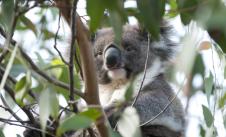
Significant impact on forest-dependent species (Fo:06) by the 2019-20 bushfires resulted in the status of forest-dependent species moving from fair to poor. Out of 70 listed species included in DEECA’s Threatened Species and Communities Tranche 1 Risk Assessment, 46 species were within the fire extent. Of these, 15 species had more than 50% of their extent burnt. The following listed species were exposed to high-severity fires across more than 50% of their overall extent:
-
Betka bottlebrush
-
Roundsnout galaxias
-
East Gippsland galaxias
-
Mallacoota burrowing crayfish
-
Orbost spiny crayfish
-
Eastern she-oak skink.
Another 2 listed species, the diamond python and the large brown tree frog, have had at least 50% of their habitat impacted by multiple high-severity fires since 2000.
Forest fragmentation (Fo:04) is a critical indicator for monitoring biological diversity. Due to the technical barriers to ensure accuracy, only a state-scale comparison was possible. The state data demonstrates that forest became more fragmented. In addition, many species increased their genetic risk because of the 2019-20 bushfires. As more frequent and higher intensity bushfires are expected due to climate change, future policy and interventions will be required to tackle this trend.
In response to the 2019-20 bushfires, the Victorian Government invested significantly in conservation efforts (Fo:05) to address the decline in the state’s biodiversity. Significant effort to reduce the impact of invasive species were made as a part of the Biodiversity 2037 program, in partnership with several organisations. Activities include predator, herbivore and weed control as well as revegetation for habitat connectivity. Captive breeding programs also contributed to protecting 7 threatened species released into protected habitat. These are the:
- Leadbeater’s possum
- helmeted honeyeater
- yellow-tufted honeyeater
- plains-wanderer
- eastern bristlebird
- eastern barred bandicoots
- orange-bellied parrot.
Despite all efforts, biodiversity in forests is deteriorating.
The 2019-20 bushfires also impacted on timber harvesting (Fo:12-Fo:14). Due to the significant biodiversity loss, VicForests developed an approach to protect the 34 species of concern. The Victorian Conservation Regulator identified species that require additional protection from timber harvesting to assist recovery from the bushfires. The 34 species included the:
-
giant burrowing frog
-
greater glider
-
glossy black-cockatoo
-
Leadbeater’s possum
-
diamond python.
In 2021 the Commonwealth and Victorian Governments agreed to undertake a Major Event Review of Regional Forest Agreements. This was in response to the 2019-2020 bushfires, to assess the impacts of the fires and identify if future remedial actions need to be taken. The Review was released in 2022. The report found a reduction of the volume of available native timber to harvest due to the 2019-20 bushfires. However, the remaining volumes available under the current Allocation Order appear to be sufficient to meet the allowable harvesting levels under the Victorian Forestry Plan (VFP) for both ash and mixed species in eastern Victoria. The changes in the timber harvesting method, along with sufficient timber resources, resulted in positive changes in assessments for timber harvesting indicators.
An announcement of a revised timeline for Victoria's commercial native timber harvesting to end by 1 January 2024 (as opposed to 2030) means that concerns over the adverse impact of native timber harvesting on biodiversity will be addressed. However, ongoing management should be applied to successfully recover harvested areas that were previously regenerated, are still regenerating or were recently harvested.
The timber harvest area successfully regenerated (Fo:15) was impacted by the 2019-20 bushfires. DEECA is responsible for the ongoing management of regenerated areas once they’re finalised and removed from the Timber Release Plan (TRP). In terms of ash forest, 82,700 hectares were impacted by the 2019-20 bushfires. There was no information available on the impact of the bushfires on mixed-species forest. Overall regeneration status, for all timber harvesting areas harvested up to June 2020 that remain on the TRP, shows that around 40% of 10,083 hectares are still active 4 to 5 years after timber harvesting. Rapidly changing fire regimes (fire intensity and frequency) pose greater challenges for successfully managing regenerating forests after timber harvesting. As a result, the status has deteriorated from fair to poor.
Many indicators deteriorated in data confidence in this reporting period, including Fo:01B, Fo:02 and Fo:10, due to the discontinuation of time-series data. Furthermore, the 2023 forest extent information was not comparable to previous SoE reporting periods (2013 and 2018) due to different analytical methods and image resolution.
Victoria's forest health has important implications for tackling greenhouse gas emissions (Fo:11). In 2020, Victoria's Land Use, Land Use Change and Forestry (LULUCF) sector was a net sink for greenhouse gasses of 21,054 CO2-e. This is equivalent to around a quarter of Victoria's total emissions and is a significantly higher proportion than national figures for the LULUCF sector (7.8%). The LULUCF sector in Victoria has been increasing net sink contributions over the past 10 years.
Report card
| Location | |||
|
Statewide |
|||
| Location | STATUS | TREND | CONFIDENCE |
|
Statewide |
|||
| Location | |||
|
Statewide |
|||
| Location | STATUS | TREND | CONFIDENCE |
|
Statewide |
|||
| Location | |||
|
Statewide |
|||
| Location | STATUS | TREND | CONFIDENCE |
|
Statewide |
|||
| Location | |||
|
Statewide |
|||
| Location | STATUS | TREND | CONFIDENCE |
|
Statewide |
|||
| Location | |||
|
Statewide |
|||
| Location | STATUS | TREND | CONFIDENCE |
|
Statewide |
|||
| Location | |||
|
Statewide |
|||
| Location | STATUS | TREND | CONFIDENCE |
|
Statewide |
|||
| Location | |||
|
Statewide |
|||
| Location | STATUS | TREND | CONFIDENCE |
|
Statewide |
|||
| Location | |||
|
Statewide |
|||
| Location | STATUS | TREND | CONFIDENCE |
|
Statewide |
|||
| Location | |||
|
Statewide |
|||
| Location | STATUS | TREND | CONFIDENCE |
|
Statewide |
|||
| Location | |||
|
Statewide |
|||
| Location | STATUS | TREND | CONFIDENCE |
|
Statewide |
|||
| Location | |||
|
Statewide |
|||
| Location | STATUS | TREND | CONFIDENCE |
|
Statewide |
|||
| Location | |||
|
Statewide |
|||
| Location | STATUS | TREND | CONFIDENCE |
|
Statewide |
|||
| Location | |||
|
Statewide |
|||
| Location | STATUS | TREND | CONFIDENCE |
|
Statewide |
|||
| Location | |||
|
Statewide |
|||
| Location | STATUS | TREND | CONFIDENCE |
|
Statewide |
|||
| Location | |||
|
Statewide |
|||
| Location | STATUS | TREND | CONFIDENCE |
|
Statewide |
|||
| Location | |||
|
Statewide |
|||
| Location | STATUS | TREND | CONFIDENCE |
|
Statewide |
|||
| Location | |||
|
Statewide |
|||
| Location | STATUS | TREND | CONFIDENCE |
|
Statewide |
|||
| Location | |||
|
Statewide (wood products) |
|||
| Location | STATUS | TREND | CONFIDENCE |
|
Statewide (wood products) |
|||
| Location | |||
|
Statewide (firewood) |
|||
| Location | STATUS | TREND | CONFIDENCE |
|
Statewide (firewood) |
|||
| Location | |||
|
Statewide |
|||
| Location | STATUS | TREND | CONFIDENCE |
|
Statewide |
|||
| Location | |||
|
Statewide |
|||
| Location | STATUS | TREND | CONFIDENCE |
|
Statewide |
|||
| Location | |||
|
Statewide |
|||
| Location | STATUS | TREND | CONFIDENCE |
|
Statewide |
|||
| Location | |||
|
Statewide |
|||
| Location | STATUS | TREND | CONFIDENCE |
|
Statewide |
|||
| Location | |||
|
Statewide |
|||
| Location | STATUS | TREND | CONFIDENCE |
|
Statewide |
|||
| Location | |||
|
Statewide |
|||
| Location | STATUS | TREND | CONFIDENCE |
|
Statewide |
|||
| Location | |||
|
Statewide |
|||
| Location | STATUS | TREND | CONFIDENCE |
|
Statewide |
|||