Spatial analysis

Background
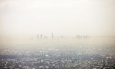
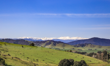
Spatial analysis involves examining and interpreting geographic data. This gives us insights into environmental processes, patterns, and relationships. It combines principles from geography, geospatial analysis, and environmental science to understand the spatial aspects of environmental issues. An example of this can be seen in Victoria’s Land Cover Time Series. The dataset gives users a visual and analytical snapshot of land cover in different areas. It also allows users to track changes in vegetation over different time periods. This information helps users understand the way land is used and managed in Victoria.
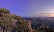
Spatial analysis gives us a better understanding of our natural environment. This lets us better predict and manage our natural resources and ecosystems. In this key topic we look to the future benefits of space and spatial information technology and how they might address biodiversity information limitations and provide solutions.
In October 2002, Environmental Science and Pollution Research published ‘An overview of remote monitoring methods in biodiversity conservation’. In the abstract, it stated:
Conservation of biodiversity is critical for the coexistence of humans and the sustenance of other living organisms within the ecosystem. Identification and prioritization of specific regions to be conserved are impossible without proper information about the sites... Therefore, more sophisticated monitoring and conservation techniques are required which can simultaneously cover a larger surface area within a stipulated time frame and gather a large pool of data.
This key topic focuses on the need for future investment in spatial analysis technology. This will address limitations in biodiversity information and support an integrated biodiversity monitoring solution for Victoria. We believe the first step along that path is an environmental Digital Twin Victoria (eDTV).
This builds on previous work by the Commissioner for Environmental Sustainability (CES) published in the Victorian State of the Marine and Coastal Environment (SMCE) 2021 Report. It also supports delivery of Victoria’s biodiversity policy, Protecting Victoria’s Environment – Biodiversity 2037. It aims to stop the decline of biodiversity and improve overall biodiversity in Victoria over the next 20 years.
Digital Twin Technology
A goal of Biodiversity 2037 is that Victoria’s natural environment is healthy. It has a target of net improvement in the outlook across all species by 2037.
But a crucial problem has been identified. How do we measure and report on progress against Biodiversity 2037 targets, and corresponding State of the Environment (SoE) biodiversity indicators in a way that is:
-
timely
-
at scale
-
cost effective
-
reliable
-
ongoing.
Space and spatial technologies can be used to improve Biodiversity 2037 and SoE reporting. They can help improve measurement of the progress of Biodiversity 2037 goals and targets.
Development of a future solution would need to be integrated into various Victorian landscapes. This would require testing on local areas, before then expanding into larger, landscape-scale levels.
The system would need to:
-
automatically collect data
-
provide real-time and post-processed data analysis
-
enable rapid dissemination of intelligence
-
inform timely reporting, investment, and decision-making of biodiversity response actions.
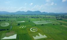
Central to the solution would be an environmental Digital Twin for Victoria (eDTV). It would be part of the existing Digital Twin Victoria (DTV) system.
A digital twin is a digital model of a physical object. It uses data on the object to simulate how the object would behave under certain conditions. Digital twins can replicate many different things, such as wind turbines or jet engines all the way up to entire cities.
Data for Digital twins
Digital twins are a virtual platform where various types of data help simulate real situations and their outcomes. Data for digital twins can come from physical assets, environmental phenomena, or sensors in the real world. The more data given to the digital twin, the more detailed the virtual build is, and the more information it can provide to users.
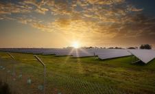
There are a variety of ways to give additional data or input to digital twins. For example, Earth observations from satellites can be helpful for mapping geographic areas and monitoring geomorphic changes.
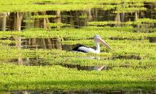
Data collected from citizen science initiatives can be fed to digital twins. Citizen science projects are collaborative endeavours between members of the general public and professional scientists. Citizen scientists will collect or analyse data that relates to the natural world. For example, the “Aussie Bird Count” asks average Australians to spend 20 minutes in their favourite outdoor space and count the birds they see. The project has a dedicated website and app where participants can record the types of birds they find.
In many instances, data collected from citizen science is analysed using machine learning. This is another important tool for digital twins. Machine learning is a type of artificial intelligence. It uses computer algorithms and models to analyse and detect patterns in data, without needing constant instruction from a user. For example, by teaching a machine to recognise the sounds of different bird calls, scientists can then feed it hours of recordings from across Victoria. The machine learning program can then identify which bird calls are present in which locations. This saves many hours of human labour.
Machine learning can help analyse the data from the many different sources available to digital twins, such as input from the Internet of Things. The Internet of Things (IoT) refers to the growing network of electronics that are all connected to the internet and communicating with one another. A device that’s part of the IoT can either send data, receive instructions, or both. This means it includes things like ‘smart’ appliances, such as fridges and lighting, as well as health devices like CPAP machines and pacemakers. But it also includes sensors in industrial machinery that aid automation, traffic lights that respond to traffic flow, and sensors on equipment that tracks energy consumption.
With the right information, digital twins can be used to:
-
perform simulations
-
identify possible dangers or improvements
-
conduct remote monitoring
-
data management, analysis and visualisation
Digital twin technology provides the ability to effect and reflect change in the real world. This in turn supports regional planning, strategic management and evidence-based reporting and investment.
Digital Twin Victoria
The Digital Twin Victoria (DTV) program is a $37.4 million investment in digital twin technology, geospatial data and spatial innovation over 4 years. The goal is to create Victoria online by 2024. The results of the program are accessible via the Digital Twin Victoria platform, which is being built in partnership with CSIRO.
The DTV platform is a browser-based tool. There are no specialist capabilities needed to use the platform. It’s made to be accessible to users with no experience using spatial data. However, there’s also more advanced functionality for specialists who want to analyse, investigate or connect to datasets. The DTV platform will continue to evolve and build over time, with more data and user feedback unlocking more opportunities.
Planners, engineers, developers and builders can use the DTV platform to:
- visualise data
- investigate the feasibility of proposals
- troubleshoot issues
- share complex information across workplaces with decision-makers.
It provides easier access to environmental and historic data, allowing users to compare the past with the present, prepare for future events and track changes over time. This includes the opportunity to digitally traverse delicate habitats or remote locations people can’t get to on foot.
DTV is helping set the digital foundations for Victoria, using data to answer new questions and make better data-led decisions.
Digital twin for the future
Digital twins offer a transformative approach to developing technology that can help address the challenges within complex natural environments.
Digital twins exist for the built environment but, to our knowledge, have not yet been applied to the natural environment. Establishing an environmental Digital Twin (eDTV) would put Victoria at the forefront in this area. The technology could be rolled out to other jurisdictions. The capability to implement an eDTV already exists within the system of DTV tools in development by Land Use Victoria within the Department of Transport and Planning.
Digital twins need significant data to be valuable. But data alone doesn't provide understanding. Actionable insights come from the analysis, interpretation and visualisation of data. A formalised collaboration would be required between DTV and DEECA. Together they could produce an eDTV that:
-
is central
-
has a spatial decision support system
-
can manage the datasets and models required for analysis and indicator assessment.
This would be supported by:
-
new methods for data creation to fill critical gaps and populate the eDTV
-
collaborations that use existing tools and datasets that are compatible between different programs (e.g. EcoCommons, Digital Earth Australia)
-
in-house experts to provide interpretations for actionable insights.
The first steps are to establish the foundation infrastructure, based on DTV. Then integrate existing Victorian Government datasets (e.g. habitat distribution models and Land Cover Time Series). As the eDTV matures it would be continually improved by updating analysis models and filling critical data gaps with new data sources, such as Earth observation combined with machine learning and Internet of Things networked smart sensors.